

| In One More to Die, smart, happy-go-lucky mum of three, Detective Inspector Kate Carter, leads a team to investigate the murder of a man found in the wreckage of a car. Upon discovering a vital clue — a vintage vinyl record from 1964 — the team are set upon a suspenseful journey of twists and turns to discover the truth. Meanwhile, Detective Inspector Kate soon finds herself contending with something dark in her own life as she becomes victim to an obsessive stalker. |
An interview with local bestselling author Joy Ellis

Upon the release of her new audiobook, One More to Die, Lincolnshire Today spoke with Joy Ellis, the Lincolnshire Fens-based crime thriller author. Having written more than 30 novels, including three series, Joy’s success can be seen in 12 UK #1 best-sellers, with her works selling over 3.7 million copies in English and translated into 14 languages.
Could you tell me a little bit about yourself and your journey to becoming a published author?
We came to live in Lincolnshire from Surrey in the millennium and I started thinking about writing as soon as we got here and I saw the location. We were wandering around the lanes one misty evening, and I thought “this is the perfect setting for a crime novel.” I started writing in earnest around five years after that. We’d retired, were enjoying ourselves, and I realised that writing is what I really wanted to do, so I buckled down and got absolutely nowhere for years. I sent books off, got loads of rejections, and became very unhappy about it. I had two books taken by a publisher who mainly dealt with hardbacks for libraries which were very expensive and very short print runs, but I knew that wasn’t the way I wanted to go. As soon as I decided it was time to give up, as I was wasting my life and that of my partner Jacqueline, I had an amazing phone call from Jasper Joffe of Joffe Books. He had picked up one of my books that I’d put on Kindle. He said he loved it and asked if I would join them. From that moment I never looked back.
You have chosen the Lincolnshire Fens as a setting for your stories for some time. How does living in Lincolnshire encourage or influence your writing?
Almost all of my books are set here. Frankly, The Fens are one of the main characters. They literally are based around The Fens and everything about them. I don’t think they would be the same anywhere else. This is just such a different kind of landscape and it’s perfect for my characters and my books.
Your new audiobook, One More to Die, has just been released on Audible, could you tell us about it and why you think people would enjoy it?
I think they’ll enjoy it for the narrator alone. Hayley Atwell (Agent Carter, Mission: Impossible, Captain America), who is a massive star, is so good. I’m delighted she said she’d do this. She has the perfect voice for my lead character, Detective Inspector Kate Carter. She’s investigating a murder but suddenly realises she has attracted a stalker and without giving too much away, it’s two things running in parallel. She’s trying to work whilst being stalked, which is very scary, and then it all gets too much. It gets quite exciting, shall we say, and because it’s a novella, where you have to get quite a lot into a short space of time, it has plenty of pace.
What inspired you to write One More to Die and what was the process of writing it like?
The process of writing was really good with One More to Die. There’s something about writing novellas; it’s very immediate and once you’ve got an idea in your head it flows very well because it’s not like mapping out a full-length novel. I really enjoyed this one. I’ve also always wanted to do a particular character who is a DI and very, very efficient, but she’s two people. At home she’s going around in her hoody and has wild kids, mad dogs and lots of cats. She’s a completely different person to who she is at work. I loved that because you can bounce backwards and forwards, and of course when somebody like this stalker intervenes and cuts into both of her lives, she finds it difficult to cope. They’ve taken away her family life and are also interfering with a murder investigation, so it provided great tension for me to work with.
What do you think it is that keeps drawing you back to writing crime thrillers?
Partly because my partner Jacqueline is a retired police officer, which helps a lot because I have a sort of in-house consultant for police procedurals, which is massive. But they also fascinate me; I’ve always loved reading mysteries since I was tiny. Put my mysteries with Jacqueline’s career and we’ve turned out with police procedurals!
You’ve written numerous books, including three series. What keeps your creative cogs turning?
Oh, heaven knows! It’s as much a surprise to me as it is anyone else, believe me! It’s little things; some tiny thing that sows a seed. I’m one of these writers that doesn’t plot or plan very carefully or lay everything out and know where everything is going. I literally write chapter one with an idea in my head and off we go. It’s kind of organic, I think.
Your series Jackman and Evans is currently being developed for television, starring Richard Armitage as DI Rowan Jackman. Do you remember how you felt upon hearing the news?
I was just over the moon. It’s a dream. I know it will be ‘based on’, rather than being the exact books, but because Richard Armitage is already my narrator for the Jackman series, I know he knows my character. He’s such a nice man and came up here to see The Fens and talk to me about my characters before he even narrated the audiobooks because he wanted to get it right, and I admire that because he is such a busy man. I can’t wait to see it. A lot of things will change, but I hope it’s done sympathetically. They have a very good screenwriter, one of the best, so let’s hope with a great cast it’ll do well!
Do you have any advice for aspiring Lincolnshire authors?
It’s very rewarding but be prepared. You’ve got to have that passion that will carry you through the bad times and when you get rejection slips back, as everyone does. Before I planned to give in, I probably had been writing for over 10 years. That’s a lot of time to commit to something, but heavens I am really pleased I did.
Do you have any other future book releases on the horizon?
I have another in the DI Nikki Galena series coming out later this year and I’m writing the next Jackman as we speak.
Where can people find you?
I have a really good website designed by a lovely young man who works for me, Luke. He’s very creative and does fabulous things on Facebook, including teasers for the next books coming out. So go through Facebook and the website, or through Joffe Books or Audible.
Is there anything else you want to add?
A thank you to everyone. We writers would be absolutely nowhere without the readers, and they have been so supportive to me. We’ve got a massive base of people who follow us. I love them all. I also want to give a huge thank you to Jasper Joffe, for trusting me and taking the books. We’ve been working together now for eight years, and he’s been a fabulous publisher. He really cares about his authors. It’s been a fantastic journey so far, and now I’m of an age I’m certainly not planning on giving up!
One More to Die is available now, exclusively on Audible.
Carenza Lewis leads hunt for Fulbeck’s role in Operation Market Garden

Time Team presenter Professor Carenza Lewis from the University of Lincoln will co-direct a dig to uncover traces of Lincolnshire’s part in Operation Market Garden, one of the largest Allied airborne landings in history.
Taking place between 15 and 17 August, “Digging Market Garden” will celebrate South Kesteven District Council’s 80th anniversary commemorations of the Battle of Arnhem, as a project collaboration between the Universities of Lincoln and Oxford, Wings to the Past, and the Ministry of Defences’ Operation Nightingale.
The dig will explore the daily routines of the 1st Airborne Division servicemen stationed at Fulbeck Manor near Grantham during the conflict, with veterans and service personnel from the Royal Air Force and British Army, and local communities all taking part in the field work.
Professor Lewis said: “Digging Market Garden is a brilliant opportunity to explore some of the ghost archaeology of World War Two, while also helping people from today’s armed forces. 80 years ago, Britain was carpeted with wartime infrastructure, including at Fulbeck where maps show a massive airbase from which ill-fated ‘Operation Market Garden’ was launched in 1944.
“Fulbeck’s wartime structures are mostly now long-gone, but childhood memories still preserve mysteries. One of these is a Nissen hut adjacent to Fulbeck Manor House, which resident Julian Fines remembers clearly, but the 1940s maps don’t extend this far so its function is unknown.
“In 2024, excavations with armed service personnel and families will hunt for clues in the beautiful Manor gardens that can tell us more about this chapter of history that is rapidly slipping beyond living memory, while simultaneously offering a positive community experience that will benefit participants’ wellbeing.
“I’m delighted to be working on this with Wings to the Past, as a follow-up to the University’s 2019 excavations at Riseholme, regaining momentum lost during the pandemic in our efforts to support military families through archaeology.”
Despite the many news reports, war diaries, and historical accounts of Market Garden, little is known about the preparations and build-up to the deployment, and the dig in August will offer a vital opportunity to investigate, record, and commemorate the airborne heritage of South Lincolnshire.
All events are free to attend and open to the public:
- 15 – 17 August, “Digging Market Garden” archaeological excavation: Fulbeck Manor, between 10am – 4pm.
- 16 August, “By Air to Battle: South Kesteven’s Airborne Heritage”; illustrated talk, Fulbeck Village Hall at 7pm.
- 17 August, Military memorabilia exhibition and finds from the excavations, Fulbeck Village Hall between 10am – 4pm.
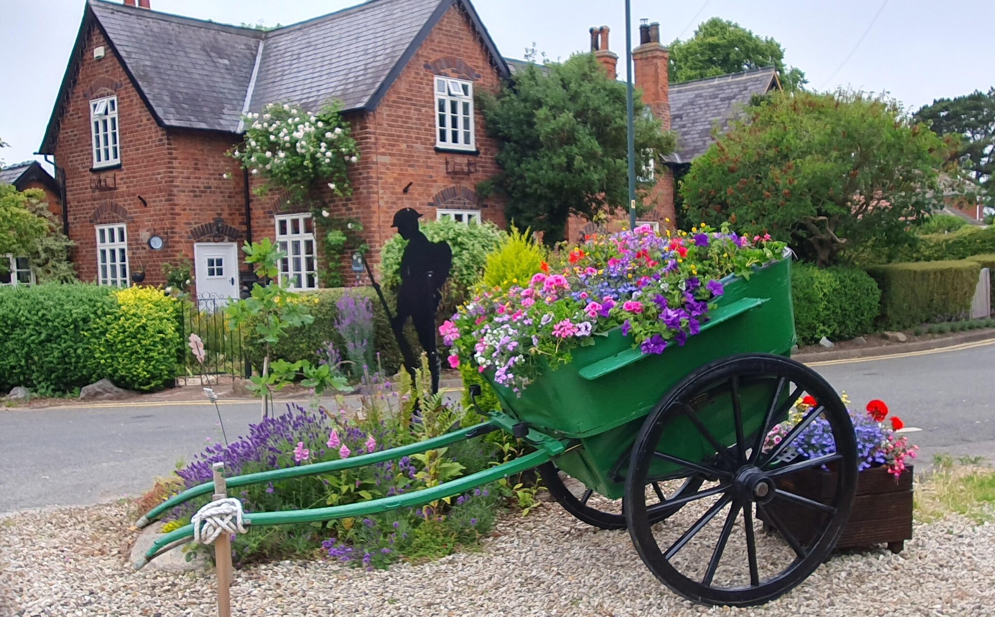
Great Coates reaches national final of Britain in Bloom contest

Great Coates has reached the national Britain In Bloom final, showcasing its impressive floral displays and community work throughout the North East Lincolnshire village.
The annual Britain In Bloom awards, run by the Royal Horticultural Society, celebrate villages, towns and cities that have gone the extra mile to beautify their area.
Having won the East Midlands in Bloom category, they were put forward to the national judging in the large village category. Great Coates is one of eight in the category including the likes of Floral Forest in Guernsey and Saundersfoot in Bloom in Wales.
Royal Horticultural Society Judges Roger Burnett and Ian Beaney visited the village to compare its displays to the other competitors before an overall winner is declared late this year.
For founders and long time residents Mike and Dawn Stewart, it’s an honour to even be nominated. Dawn said: “We started the group five years ago after myself and Mike wanted to make the area near the war memorial look more appealing.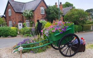 “After that, two of our friends decided they wanted to help us do more to the village in general and it went from there.”
To start with, Dawn and Mike spent four hours a day taking milk bottles full of water around the village for the flowers they’d planted. Now, the 16 strong volunteers take it in turn watering the 160 displays, taking two hours at a time.
“I’ve lived here 65 years now and we just want to bring it back to it’s former glory and hopefully put North East Lincolnshire on the map,” said Dawn.
Clerk of the village council, Carl Thomas, is also part of the volunteer group and says that there is more to their efforts than just flowers. “We litter pick, commemorate significant events and look after the train station after becoming adopters on behalf of East Midlands Railway and work with local community groups to teach them about gardening.”
“After that, two of our friends decided they wanted to help us do more to the village in general and it went from there.”
To start with, Dawn and Mike spent four hours a day taking milk bottles full of water around the village for the flowers they’d planted. Now, the 16 strong volunteers take it in turn watering the 160 displays, taking two hours at a time.
“I’ve lived here 65 years now and we just want to bring it back to it’s former glory and hopefully put North East Lincolnshire on the map,” said Dawn.
Clerk of the village council, Carl Thomas, is also part of the volunteer group and says that there is more to their efforts than just flowers. “We litter pick, commemorate significant events and look after the train station after becoming adopters on behalf of East Midlands Railway and work with local community groups to teach them about gardening.”
 “After that, two of our friends decided they wanted to help us do more to the village in general and it went from there.”
To start with, Dawn and Mike spent four hours a day taking milk bottles full of water around the village for the flowers they’d planted. Now, the 16 strong volunteers take it in turn watering the 160 displays, taking two hours at a time.
“I’ve lived here 65 years now and we just want to bring it back to it’s former glory and hopefully put North East Lincolnshire on the map,” said Dawn.
Clerk of the village council, Carl Thomas, is also part of the volunteer group and says that there is more to their efforts than just flowers. “We litter pick, commemorate significant events and look after the train station after becoming adopters on behalf of East Midlands Railway and work with local community groups to teach them about gardening.”
“After that, two of our friends decided they wanted to help us do more to the village in general and it went from there.”
To start with, Dawn and Mike spent four hours a day taking milk bottles full of water around the village for the flowers they’d planted. Now, the 16 strong volunteers take it in turn watering the 160 displays, taking two hours at a time.
“I’ve lived here 65 years now and we just want to bring it back to it’s former glory and hopefully put North East Lincolnshire on the map,” said Dawn.
Clerk of the village council, Carl Thomas, is also part of the volunteer group and says that there is more to their efforts than just flowers. “We litter pick, commemorate significant events and look after the train station after becoming adopters on behalf of East Midlands Railway and work with local community groups to teach them about gardening.” Project to support hospital patients with sensory needs needing emergency care

A new project is launching to support hospital patients with sensory needs who are in need of emergency care.
Sensory friendly resource bags are being made available at Lincoln, Boston and Grantham hospitals.
Patients with sensory needs often find Emergency Department environments overwhelming, due to all of the noises and activity.
To support patients with autism or learning disabilities, United Lincolnshire Hospitals NHS Trust is introducing the bags which include items such as noise-cancelling headphones, an eye mask, stress ball, a sensory chew bracelet and a colouring book with pencils. Each bag also contains an easy-read patient information leaflet and a feedback form to gather insights for continuous improvement.
Specialist Safeguarding Learning Disability Nurse Kerry Poberezniuk, Safeguarding and Vulnerabilities Nurse Specialist for Dementia Zoe Chapman and Patient Experience Manager Sharon Kidd came up with the idea.
They also had support from Lincolnshire patients who are experts by experience. One such expert by experience is David. He said: “These bags are really great and helpful. I wish they had been around the last time I came to A&E as they really would have helped me. At least I know to ask for one if I ever need to attend in the future.”
Kerry said: “Our new sensory friendly bags are designed to help create a calm and safe space when senses become overwhelmed and there is a need to get away from the outside world, ultimately giving our patients a better experience whilst waiting to be seen and cared for.
“The feedback from staff has been incredible. It’s truly inspiring to see how such a simple idea can have a huge positive impact on someone’s healthcare experience. The bags are especially useful for patients who arrive unexpectedly and do not have their own coping items.”
Staff can also update a patient’s records to help improve communication during their stay and also identify any additional support they might need during future visits.
The bags have been funded by the United Lincolnshire Hospitals Charity. Charity Manager, Ben Petts, said: “Nobody ever wants to visit an Emergency Department, but it is even more daunting and overwhelming for people with learning disabilities. As a charity we fund the extras not covered by the NHS and our proud to be supporting these bags.”
Kerry added: “Together, we can make a real difference to the hospital experience for patients with sensory needs.”
Image credit: Stock.adobe.com/smolaw11
The Grove Care Home host open day to showcase luxury refurbishment

The Grove Care Home in Waltham is excited to welcome visitors to an open day on Wednesday, 21st August, from 2:00 pm to 4:00 pm.
Everyone is invited to tour the newly extended and refurbished facilities, meet the friendly staff, and enjoy complimentary food and refreshments. The residential care home now features 19 additional en-suite bedrooms, revamped lounge and dining areas, a coffee club café, and an elegance hair salon. The Grove provides residential, dementia, and respite care, ensuring full support for all residents.
 Kelly Loft, Home Manager, said: “As a family-run company, we provide the type of care we’d want for our own loved ones. I am very proud of our dedicated team at The Grove Care Home, whose commitment truly enhances our residents’ lives.”
Customer Relations Manager Ros Wells added: “Our goal is to create a ‘home from home’ atmosphere at The Grove, and the refurbishment has greatly contributed to this. Our rooms and communal areas are clean, bright, airy, and uplifting, helping our residents settle in quickly and feel at home.”
The interior design has been thoughtfully chosen to encourage reminiscing and conversation, featuring calming themes like the seaside with imagery, books, and other items to explore.
“Our residents love the new spaces and enjoy stopping to look at the themed pictures on the walls,” Ros Wells explained. “These areas have sparked more sharing about their lives and backgrounds.”
Kelly Loft, Home Manager, said: “As a family-run company, we provide the type of care we’d want for our own loved ones. I am very proud of our dedicated team at The Grove Care Home, whose commitment truly enhances our residents’ lives.”
Customer Relations Manager Ros Wells added: “Our goal is to create a ‘home from home’ atmosphere at The Grove, and the refurbishment has greatly contributed to this. Our rooms and communal areas are clean, bright, airy, and uplifting, helping our residents settle in quickly and feel at home.”
The interior design has been thoughtfully chosen to encourage reminiscing and conversation, featuring calming themes like the seaside with imagery, books, and other items to explore.
“Our residents love the new spaces and enjoy stopping to look at the themed pictures on the walls,” Ros Wells explained. “These areas have sparked more sharing about their lives and backgrounds.”
 If you would like to experience the warmth and care of The Grove Care Home firsthand, please contact Ros Wells, Customer Relations Manager, at 01472 821 127 or via email at ros.wells@countrycourtcare.com.
 Tickets go on sale for Belton House’s magical new Christmas lights trail this winter

Tickets to Christmas at the National Trust’s beautiful Belton House in Lincolnshire are now on sale for its spectacular seasonal trail.
Open to visitors from Friday, November 22 to Wednesday, January 1, the immersive experience includes thousands of twinkling lights, colourful trees and larger-than-life illuminations.
Matthew Findlay, Head of UK Trails for Sony Music/Raymond Gubbay Ltd, said: “We were thrilled with the fantastic response from visitors who enjoyed the trail last Christmas and our planning and preparation for 2024 is already well underway. Look out for some sparkling new innovations and installations this year.”
Created by award-winning, internationally acclaimed light trail producers and firmly positioned within the UK’s seasonal calendar, Christmas at Belton has everything you need for an unforgettable time with friends and family, including a magical glimpse of Father Christmas along the way.
Discover a meadow of light stretching out into the distance, larger-than-life neon string flowers, candles floating high into the sky and battens of light that change colour in time to music.
Grab a seasonal snack from one of the hand-picked street food vendors who bring an indulgent twist to tempting treats on offer. Complete your walk under the stars with a festive *spiced winter warmer, *hot chocolate or *toasted marshmallow and share it with someone special.
Your very merriest Christmas starts here. Limited capacity with timed entry. Plan now to secure the date and time of your choice.
*separate charges apply
Christmas at Belton is brought to you by Sony Music Limited in partnership with the National Trust. The trail is created by Culture Creative.
What: Christmas at Belton – The after-dark illuminated trail through festive gardens
When: From 22 November to 1 January. Open from 4.30pm, last entry 8pm and closes at 10pm.
Why Visit: Discover a Christmas illuminated trail for all the family set within the beautiful landscape of Belton House.
Admission: Limited capacity with timed entry, early booking advised.
Off-peak: Adult £15, Child £10, Family £47 (2 adults & 2 children). Standard: Adult £22.50, Child £16, Family £74. Peak: Adult £24, Child £18, Family £81. Free entry for carers and children aged 2 & under.
Parking £8 per car. Free for National Trust members when booked in advance.
Website: Christmas at Belton tickets | Tours and Events | Ticketek UK
Address: Belton House, Grantham, Lincolnshire, NG32 2LW
Image: Christmas Cathedral by Mandylights. My Christmas Trails 2023. Photo by Sony Music
ABP seeks Listed Building Consent for Grimsby’s unique Dock Tower

Listed Building Consent has been sought for conservation works on Grimsby’s iconic Dock Tower landmark, the only one of its kind in the country.
Owners ABP wants to embark on key structural repairs on the parapets, building of a new staircase, and drainage. If approved by North East Lincolnshire Council, work could start on the historical structure later this year in the hope it can reopen to the public.
Simon Bird, Regional Director of the Humber ports, said: “It was during some routine maintenance work that it was picked up some of the further works that needed to be done to ensure the tower remains safe and accessible for the future.
“The Dock Tower is the jewel in the Port of Grimsby. It has been a beacon to so many over the years and for Grimbarians it is a symbol of home. As its custodians we have over the years spent time and money maintaining it, as it has such architectural historic value, and will be here for many more years to come once these essential works are carried out.”
Jenny Bulmer, Conservation Engineer of Alan Wood & Partners said: “Opportunities to work on such a unique and historically significant building as this come about rarely. Being able to discover some of the building archaeology and the history of its use throughout the process is a real privilege. Getting to see the tower brought back to life with a renewed purpose is something we can all look forward to.”
Standing 309 feet (94.2m) tall to the top of the lantern, the tower was finished on 27 March 1852 to power the hydraulic machinery of Grimsby docks. Its height was to achieve the sufficient pressure needed to operate the machines.
It was built by James Meadows Rendel, the civil engineer who constructed the docks at Grimsby between 1844 and 1853 and opened by Queen Victoria when she visited the port in October 1854. The designer was James William Wild, an architect born in Lincoln.
The current plans submitted include:
- Insertion of a new staircase
- Installation of internal lighting
- Brickwork repairs
- Metalwork repairs
- Paintwork
- Roofing
- Floor repairs
- Drainage
- Interpretation panels
Archaeological dig at historic Fulbeck Manor hoping to unearth military heritage

An archaeological dig at historic Fulbeck Manor is hoping to unearth airborne forces military heritage at a key WW2 location.
The Digging Market Garden project (15-17 August) is part of South Kesteven District Council’s 80th anniversary commemorations of the battle of Arnhem – Operation Market Garden – the largest airborne landing in history.
There is also a talk on British, American and Polish paratroopers’ presence in South Kesteven in the village hall at 7pm on Friday (16 August) by military heritage specialist Brian Riley. By Air to Battle: South Kesteven’s Airborne Heritage is free to attend with tickets bookable via Ticket Tailor https://bit.ly/skdc-byairtobattle
The village hall will stage a military heritage exhibition on Saturday (17 August) between 10am and 4pm.
The dig is a partnership between the Council and Oxford University, the University of Lincoln, Wings to the Past and Operation Nightingale, assisting the recovery of wounded, injured and sick military personnel and veterans through involvement in archaeological investigations.
Maj General Roy Urquhart, Commander of the British First Airborne Division, was billeted in the Manor in the 1944 build up to battle with engineering units in the stables – now Fulbeck Craft Centre.
Maj Urquhart’s daughter Judy Urquhart is making a special visit to Fulbeck where she will be introducing Brian Riley’s talk.
Archaeologists, serving and forces veteran dig volunteers will be on site between 10am – 4pm, looking at the sites of former Nissen huts with the public invited to observe.
Cllr Richard Dixon Warren, SKDC Armed Forces champion, said: “This is an incredible opportunity to learn more about Fulbeck’s very special backstory linked to the British First Airborne Division. We are very much hoping that the dig will act as a springboard to more archaeological explorations.”
Tim Clack, the Chingiz Gutseriev Associate Professor of Archaeology and Anthropology at the University of Oxford, said: “Operation Market Garden is one of the most controversial episodes of the Second World War
“Our Digging Market Garden project offers a unique opportunity to unearth some of the hidden heritage and backstory of the operation.
“Starting in the grounds of the picturesque Fulbeck Manor, the project aims to tell a previously untold part of Market Garden. This is the story of the daily routine, preparations, training, and life amidst the local community of airborne forces prior to their departure for combat.
“It is incredibly fitting that in bringing this past to life, the project team comprises archaeologists and historians with strong links to the local area as well as veterans and service personnel. To be able to start this project in the 80th anniversary year of the Operation Market Garden makes it especially poignant.
“As an Allied offensive, Market Garden aimed to circumvent the strongest of the German defences, avoid the casualties of a broad front approach, and held the prospect of accelerating the defeat of Hitler’s regime.
“The operation involved the largest airborne landing in history, courageous and daring assaults and heroic defences, but, ultimately, a series of strategic mistakes ensured its failure.”
Fulbeck Arnhem Event:
15-17 August. Digging Market Garden archaeological excavation: Fulbeck Manor. 10am-4pm.
16 August. By Air to Battle: South Kesteven’s Airborne Heritage; Illustrated talk. Fulbeck Village Hall. 7pm.
17 August. Military memorabilia exhibition. Fulbeck Village Hall. 10am-4pm. Free entry.
Image credit: Stock.adobe.com/Mariana Rusanovschi
Husband and wife make £10,000 donation to thank hospital team

Robert and Maureen Macdonald have donated £10,000 to purchase lifesaving equipment to say thank you to the hospital team who resuscitated her.
Maureen suffers from atrial fibrillation (AF), a heart condition that causes an irregular and often abnormally fast heart rate. As a result she has had several visits to the Emergency Department at Pilgrim hospital and to the Acute Cardiac Unit.
Maureen said: “I have AF and I cannot control it. I have also had a pacemaker and four stents fitted. Sometimes my heart rhythm just flips out and there is nothing I can do. It is just so exhausting and makes me so tired.
“I have had several trips to the hospital and stays on the Acute Cardiac Unit. I can honestly say they are the most amazing team. I owe them my life, without them I would not be here today.”
On Friday 5 April, Maureen’s heart stopped while she was in hospital. Staff on the unit were joined by the Critical Care Outreach team who all worked together to perform CPR and successfully resuscitated Maureen.
Maureen said: “The only thing I can remember is that as I came back, Deputy Sister Molly Parker was holding my hand and telling me that everything was going to be OK.
“Thanks to all of their efforts and care I was then able to attend my daughter Zoe’s wedding just a couple of months later. They gave me the gift of life and time. How can you put a price on that? Thank you just didn’t seem enough.”
Towards the end of April staff at the hospital held a 12 hour CPR-a-thon to raise funds to purchase a machine that performs mechanical chest compressions if a person has a cardiac arrest and CPR is prolonged.
The hospital already had a LUCAS CPR Chest Compression System machine within the Emergency Department to help to resuscitate patients, however on occasions this had not been available for use in other parts of the hospital. So the team organised the event which saw members of the Critical Care Outreach Team, the Hospital Out of Hours Team, the Acute Cardiac Unit Team and the Intensive Care Unit Team performing CPR for 12 hours non-stop on a mannequin.
Maureen heard about the event and had a chat with Robert.
She said: “I asked him what price he would put on my life? And when I suggested £10,000 he completely agreed that we would fund the device and donate the money.”
Robert added: “They have given us everything. As the saying goes ‘you cannot take it with you when you go’ and so we didn’t think twice. We just hope that it helps this amazing team to save even more lives, just like they did with Maureen.”
The Holbeach couple are both aged 82 and have been married for 62 years. They met at school and have two children and two grandchildren. Their daughter Zoe joined them on the visit to the hospital.
Acute Cardiac Unit Sister, Chelsea Spencer, said: “I am the proudest sister in the whole hospital. It is so special to see Maureen well today and not needing our care. We are all so moved and grateful for this amazing donation from the Macdonalds. But the best gift of all is getting to see Maureen as a visitor and not as a patient.”
Critical Care Outreach Advanced Clinical Practitioner, Hayley Head, organised the CPR-a-thon. She said: “Robert and Maureen’s support will help us to save lives. We couldn’t believe it when we heard all of the money had been raised. It was so emotional for all of us and when we realised it had come from the Macdonalds we were all so moved. They are an amazing couple and we have named this device ‘the Macs’ in recognition of their amazing generosity.”
The couple donated the money to the United Lincolnshire Hospitals Charity who then used the funds to purchase the device.
Fundraiser Gary Burr said: “Robert and Maureen are an amazing couple. In life you meet certain people who leave an imprint on your heart and they have certainly done that on the unit and within our charity team. They are like a ray of sunshine who bring joy and laughter wherever they go. We will never be able to thank them enough for their amazing generosity.”
A couple of days after the visit, ‘the Macs’ was used for the first time and helped to save a patient’s life.
Image credit: Stock.adobe.com/Stockfotos-MG
Police called in to probe ashes irregularities at Lincoln Crematorium

City of Lincoln Council has called in the Police to look into suggestions that staff at Lincoln Crematorium have not dealt with the burial of ashes in accordance with the wishes of the families of the deceased.
An investigation into one of six alleged cases has begun, and he council has commissioned an urgent inspection of the facility by the Federation of Burial and Cremation Authorities.
Angela Andrews, Chief Executive of City of Lincoln Council, said: “I am shocked and distraught to confirm that a small number of families did not receive the level of care and service they and their loved ones deserved, and rightly expected, in relation to the burial of their loved ones’ ashes.
“They were let down at a time when they needed the high level of dedication and professionalism that our crematorium team has always been proud to provide.
“I have personally visited or spoken to the six families identified as being directly affected by this situation, to work out how we can best help them through this difficult time and to offer our deepest apologies.
“I have been humbled by the responses I received from these families, and we are working with them to agree on lasting tributes to their loved ones.
“We have brought in experienced industry professionals to support the operation of Lincoln Crematorium and ensure we can continue to deliver a committed and professional service. I can reassure anyone using this service that the high standards required are being met.
“I would like to reassure those who have previously used the crematorium that there is no evidence of any other families being affected, other than those we have already been in contact with.
“This situation came to light thanks to concerns raised by council staff. We have launched a thorough internal investigation into what happened, and how it happened, and our initial findings have been shared with Lincolnshire Police who are now investigating one of the incidents.
“While a police investigation is ongoing, it is not possible for me to say any more. We will also be conducting a full internal review into the crematorium’s processes and procedures and will provide a further update on this in due course.
“I would like to reiterate how deeply sorry I am to all those affected by what has happened.”
Grantham runner steps out in aid of Lincs & Notts Air Ambulance

Lincs & Notts Air Ambulance (LNAA) is saying a big thank you to a Grantham runner who has raised over £3,000 for the charity’s life-saving work and is already planning her next race.
Since her first run in 2021, Rachel has taken part in two Great North Runs and last year’s London Landmarks half Marathon. She is currently training for her third Great North Run with her daughter, Jess, which is taking place on 8 September in Newcastle.
Rachel Hamilton has run numerous races in support of LNAA over the years. She said: “As a family we have needed the Lincs & Notts Air Ambulance not once but twice. I ran the Great North Run in 2022 in memory of my dear dad who we sadly lost eight years ago and for my aunty, Jane Gosbee, when she was involved in a road traffic incident in 2021. Without the help of the crew she may not be here today.”
Georgia Watson, Events Manager, has full admiration for Rachel for her fundraising efforts. She said: “It is fantastic, what Rachel has achieved in the last few years. As a charity, Lincs & Notts relies on its supporters like Rachel to raise the £13million needed to keep our Air Ambulance and fleet of Critical Care Cars operational.”
Farmers, landowners, and managers are being asked their opinions on how wildlife can be best conserved and enhanced across the landscapes of Greater Lincolnshire.
Their opinions will help develop a Local Nature Recovery Strategy that shapes how nature can recover, and which guides opportunities for funding to work with, or restore nature, on swathes of Lincolnshire through Biodiversity Net Gain and Environmental Land Management Schemes.
Cllr Colin Davie, executive member for environment at Lincolnshire County Council, said: “Putting together a Local Nature Recovery Strategy for Lincolnshire will help to identify suitable locations for nature recovery activities in the future, and in turn, tap into funding for these activities that will help deliver the strategy’s goals.
“With your help, the strategy has the potential to steer opportunities for nature-based solutions such as flood risk management and sequestering carbon through new trees, woodlands and healthier soils.”
He added: “We need you to ensure The Greater Lincolnshire Local Nature Recovery Strategy is realistic and achievable, while still protecting food security for future generations.” He encouraged farmers and landowners to take part in a 15-minute survey on the Lincolnsire County Council web site.
Free craft workshops support revamped Market Place in Grantham

Free craft workshops and wandering street performers will bring fun activities to the newly-revamped Market Place in Grantham.
The drop-in events are open to all and will guide visitors as they create huge, colourful lanterns ahead of a community festival planned for the autumn.
They will be supported by entertainment from professional theatre companies, bringing performance, puppetry and music to the streets.
Deputy Leader of South Kesteven District Council, Cllr Paul Stokes, who is also Cabinet Member for Leisure and Culture, said: “It’s a real pleasure to be able to host a series of events and entertainment in Grantham town centre as we look forward to more of the same when the roadworks have moved away.
“The pop-up workshops and street theatre will build towards a community festival and parade in October when the lanterns we create will be used to celebrate Grantham and its wide and diverse communities, their past and their future.
“Participants will also be invited to share their memories of Grantham, which will form part of the final event, and we look forward to hearing their thoughts.”
It is part of the activity connected with the rebuild of Market Place, supported by funding from the Future High Street Fund of the Ministry of Housing, Communities and Local Government, which is bringing an open community space where people can meet, chat, eat and shop.
Emilie Nunn, who is organising the craft workshops, said: “Everyone is welcome to join us as we get ready for Grantham’s Festival of Community by creating lanterns to form part of the Festival parade.
“We’re also inviting people to pop along and share memories and stories of Grantham’s past during our free drop-in workshops. Everyone is welcome!”
In addition to the scheduled workshops, Emilie is running two events with community groups who would find attending a drop-in event difficult, with the dates and venues to be announced.
Pop-Up Community Workshop dates:
The Clock, 12-13 Westgate, Grantham, NG31 6LT (10am-3pm)
- Thursday 15th August
- Wednesday 21st August
- Saturday 24th August + Barmpot Theatre performances
- Monday 26th August
- Wednesday 28th August
- Saturday 31st August + street theatre performances
- Monday 19th August
Something for everyone at Burghley this summer

Summer is in full swing, meaning there are lots of exciting happenings at Burghley this month.
Something for everyone…
There is a sensational season of summer events & experiences lined up for families looking for the perfect day out, or if you are looking for something a little different.
Choose from a whole range of engaging and inspiring Children’s Workshops & Activities.
Make It Mondays
5, 12, 19 August | £5 per child
Time Travel Tuesdays
6, 13, 20 August | £5 per child
Wild Wednesdays
7, 14, 21 August | £5 per child
Beastly Boring Tours
5-17 August (excl. Fri & Sun) | £15 per person
Look out for pop-up events included for free with an Admission Ticket or Annual Pass.
Nature Trails in the Gardens
8, 15, 22 August | Included with Admission
Storytelling in Hide & Secrets
9, 16, 23 August | Included with Admission
Birds of Prey Day
11 August | Included with Admission
Learn something new at an expert-led adult workshop.
Sumi-e Japanese Ink Painting Workshop
Wednesday 14 August
Japanese Tea Ceremony Workshop Wednesday 11 September
Ikebana Workshop Thursday 12 September
Sculpture Workshop 15 September
The return of a summer favourite…
The Summer Fine Food Market will be showcasing the best of local and international food and drink on August Bank Holiday weekend.
Free admission and car parking at no charge. 10am to 4pm each day (24-26 August).
The world’s greatest 5* equestrian event…Defender Burghley Horse Trials
There is just over one month until the world’s best riders & horses compete for Defender Burghley glory in the historical grounds of the Parkland (5-8 September).
Witness equestrian eventing at its best, experience the finest shopping and hospitality, and create unforgettable memories with family and friends.
Everything you love at Burghley…one of the most magnificent stately homes in the country.
Visit Burghley House | Open daily (excl. Fridays) 10.30am – 4.30pm
Vibrant, atmospheric gardens filled with sculptures, surprises and sensational colour.
The Gardens | Open daily 10am – 5pm.
Endless hours of outdoor fun at Hide & Secrets Adventure Play!
Adventure Play | Open daily 10am – 5pm.
Want to visit Burghley again & again? Buy an Annual Pass today to take advantage of unlimited visits throughout the open season and experience everything Burghley has to offer, as often as you like.
Temporary Changes to Parkland Access
Parkland Access | 5 August to 20 September
The central access route through Burghley Parkland is to be closed to pedestrians from Monday 5 August to Friday 20 September. The restricted access is in place to ensure the safety of Park users during the site build and breakdown periods for the 2024 Defender Burghley Horse Trials. The restricted area will be clearly signposted at key points in the Park. The Main Visitor Entrance at Pilsgate Lodges on Barnack Road is unaffected.
Burghley House and all visitor facilities are open as normal, with the exclusion of the dates of the Defender Burghley Horse Trials (5-8 September) when all visitor facilities close for the event.
Alternative Pedestrian Route | 6 August to 1 September and 10 to 20 September
An alternative pedestrian route will be in place to provide access through the Parkland. The temporary pedestrian route operates 7am to 8pm from Tuesday 6 August to Sunday 1 September and Tuesday 10 to Friday 20 September. Please be aware this route is mainly on grass with some areas of uneven terrain.
Look out for the pop-up coffee van along the way which will be serving up delicious drinks and snacks next to the beautiful Lion Bridge.
The Parkland will fully reopen on 21 September.
New plan aims to plant 200,000 trees in Lincolnshire by 2026

In a landmark event at the Bowthorpe Oak near Bourne – reputed to be England’s oldest oak tree – Lincolnshire County Council and the Woodland Trust have officially launched the LincWoods project.
This ambitious initiative aims to plant 200,000 trees across Lincolnshire by 2026, significantly enhancing the region’s green spaces and biodiversity. It will mean over 130 football fields’ worth of new woodland and 20,000 metres of new hedgerows.
The Bowthorpe Oak is estimated to be over a thousand years old and boasts the widest girth of any oak to its kind in the UK at 13.38 metres.
The county council and Woodland Trust’s partnership agreement outlines a collaborative effort to deliver the MOREwoods and MOREhedges schemes to landowners across Lincolnshire. Through this initiative, landowners can receive funding and support for planting trees and hedges, contributing to the county’s environmental goals.
Cllr Martin Hill, Leader of Lincolnshire County Council, expressed his enthusiasm for the project. He said: “This partnership represents a significant step forward in our commitment to environmental sustainability. By collaborating with the Woodland Trust, we can profoundly impact our local landscape and biodiversity, ensuring Lincolnshire remains green and vibrant for future generations. In a thousand years, our descendants may well be standing in the shade of oaks planted by LincWoods. It’s an inspiring legacy.”
Paul Woodgate, Outreach Officer for the Woodland Trust, highlighted the importance of community involvement. He said:
“The LincWoods project is a fantastic opportunity for local landowners to play a crucial role in enhancing our natural environment. We are proud to support Lincolnshire County Council in this initiative and look forward to seeing the positive outcomes – for nature, people and climate – of our combined efforts. There will be free tree and hedgerow pack giveaway events this Autumn.”
The project offers substantial subsidies for tree and hedge planting. This funding from Lincolnshire County Council, combined with support from the Woodland Trust and Lloyds, ensures that the cost to landowners is minimised, encouraging widespread participation.
Lincoln’s London Camera Exchange organises unforgettable day of photography and wildlife at Yorkshire Wildlife Park

Join an unforgettable day of photography and wildlife at the stunning Yorkshire Wildlife Park, organised by Lincoln’s London Camera Exchange.
On Saturday 14 September (09:30 – 18:00), experience the thrill of photography with Canon cameras and lenses. Get an exclusive first look and hands-on opportunity to test the new Canon EOS R1 and Canon EOS R5 Mark II.
There will be the latest photography gear from the EOS R series and RF lenses for you to try out during the day. Some items will be in high demand, so sharing may be necessary!
Danny Green, Canon Professional Photographer, will be present to offer expert advice and techniques for capturing the perfect animal shots. Danny will also go through a presentation on the day talking about his work and why he uses Canon cameras and lenses.
With limited spaces available, book now: https://www.lcegroup.co.uk/New/?Product=C1A6B18A-E62B-4BB5-B82B-1FA4FF48FD22
Ticket Price: £60, which includes access to Yorkshire Wildlife Park, the use of Canon equipment, hot & cold drinks throughout the day, and a meal at lunchtime.
Affordable food hub launches in South Kesteven

A national charity, The Bread and Butter Thing (TBBT) is launching its third food hub in Lincolnshire, bringing fresh, healthy affordable food to the area’s low income communities.
Funded by South Kesteven District Council’s UK Shared Prosperity Fund (UKSPF), and Comic Relief, the new hub will open at 1pm on Friday 9th August at West Grantham Community Centre.
This is in addition to sister hubs already operating out of Market Deeping and Stamford.
Cllr Rhea Rayside, SKDC Cabinet Member for People and Communities, said: “We are committed to supporting anyone who’s struggling in South Kesteven so it’s great to be working with The Bread and Butter Thing on the launch of their latest hub.
“If you’re looking for fresh, healthy, food that eases the strain on the purse strings, we urge you to come and check out any of their food hubs. We are very fortunate to have them here at a time when so many families are struggling.”
TBBT Chief Executive Mark Game said: “We’re delighted to be working with SKDC again and expanding our Lincolnshire offering.
“We’re all about helping food budgets go further by providing our members with nutritious food that doesn’t break the bank.
“We’re on a mission to make sure everyone has access to great food, improve diets, strengthen struggling communities and help save money. Our members tell us they can save up to £35 a week by shopping with us, which frees up budget for other household priorities.”
At its weekly hubs, TBBT members can collect three bags of fruit and vegetables, chilled food and cupboard staples at discounted prices, to feed their families, improve their diets and save money for other household priorities.
Members pay £5 for a single bag, £8.50 for a three-bag family package or £17 for a large family package of six bags. It is a low-cost weekly shop that provides essential produce for family eating – fresh fruit and veg, fridge favourites and cupboard staples that allow members to eat better and cook more.
Image courtesy of South Kesteven District Council
89,000 tonnes of rock armour delivered for Stallingborough sea defences

Aggregate Industries, a building materials supplier, has delivered 89,000 tonnes of rock armour as part of the Environment Agency’s £29 million Stallingborough Sea Defence Improvement Scheme.
Aiming to enhance coastal defences and protect critical infrastructure along the Humber Estuary, between the ports of Immingham and Grimsby, this ambitious project required 70,000 tonnes of granite to be shipped from Aggregate Industries’ Glensanda superquarry in Western Scotland via Immingham Dock.
The granite, with each piece weighing between 0.3 to 1.0 tonnes, made its two-day sea voyage aboard the 90-meter-long Hagland Saga. Each of the 17 shipments carried approximately 4,500 tonnes. Upon arrival at Immingham, the cargo was swiftly offloaded and transported by road to the Stallingborough project site.
Additionally, 19,000 tonnes of smaller grade rock armour, ranging from 60kg to 300kg, were sourced from the firm’s Bardon Hill quarry in Leicestershire and delivered in approximately 700-tonne loads.
In collaboration with Jackson Civil Engineering, Aggregate Industries ensured a seamless delivery, overcoming challenges such as unpredictable docking times and the migration of vital bird species which limit works within the designated Humber Estuary site between April and September every year.
Nick Gilbert, business development manager for Aggregate Industries, adds: “We are proud to have played a crucial role in protecting Stallingborough and its surrounding areas.
“Our comprehensive network and methods enabled us to meet the logistical challenges of this complex and reactive project which effectively saw the equivalent of a quarter of the Humber Bridge’s tonnage seamlessly delivered and discharged, directly contributing to the safety and resilience of the local community.”
The Stallingborough Sea Defence Improvement Scheme is the third phase of ongoing coastal improvements and is designed to provide a further 25-year design life to the current flood defence embankments.
This project will see the repair and fortification of a 4.5km stretch – including some 3km of rock armour – with the works comprising resealing and improvements of existing revetments, some of which date back to the 1953 North Sea flood. This effort will safeguard 2,300 homes, vital infrastructure and industry, as well as precious habitats in the Stallingborough area.
Nigel Priestley, Senior Project Manager for the Environment Agency, said: “Aggregate Industries have provided a great service to Jackson and the Environment Agency by supplying the smaller rock to allow installation to commence in 2023, and then the larger rock from Oban, through the winter, impacted by numerous storms, in time for a March 2024 start.
“The option to deliver by boat from the UK has also saved a significant amount of carbon too and minimised transportation by road.”
The granite used in this project, known for its durability and longevity, is an ideal material for modern sea defences. With a lifespan exceeding 100 years, these specialist aggregates are designed to withstand harsh weather conditions and dissipate wave energy, mitigating soil erosion and maintaining the natural integrity of the landscape.
Beyond its protective capabilities, the rock armour also promotes vegetation growth and facilitates habitat creation, aligning with Aggregate Industries’ commitment to environmental sustainability.
Council calls on firms to employ more ex-forces staff

South Kesteven District Council is calling on local companies to follow its lead in recruiting ex-military personnel.
Sixteen former Armed Forces individuals, mainly from the Army, now play key roles in the council’s waste and recycling and Street Scene teams.
They have transferred valuable skills developed from service with the Royal Logistics Corps, Infantry regiments, Royal Anglian Regiment and the Armoured Corps.
Others served with the RAF and the RAF Regiment, Royal Artillery, Royal Engineers and even the Household Cavalry. Service has included tours of Afghanistan, Iraq and Northern Ireland.
Two members of the council’s keen-eyed and effective CCTV team are also ex-Army – the Royal Artillery and the Grenadier Guards – and the council’s head of economic development is from an Armed Forces background.
Cameron Greene now applies service skills developed with the Army’s Royal Engineers to managing the council’s Street Scene operation.
He said: “We now have nine ex-military on the Street Scene team, all dedicated to getting the job done as they used to do for the Armed Forces.
“In many ways the council suits those who have served in the military. There is a clearly defined structure, opportunities to progress and a great team spirit.”
Waste team HGV driver Cheryl Miller served with the Royal Auxiliary Air Force. She said: “I drove Land Rovers, armoured personnel vehicles and Bedford four-tonners. I have always been a driver and have been able to transfer those skills.”
Cheryl, who initially gained her HGV licence to drive her family’s American motor home, joined SKDC during the Covid pandemic.
“My husband had an accident and I needed to work,” she said. “The Council needed drivers, I applied and here I am. I love the job!”
Another HGV driver, Mick Toms, served with the Royal Engineers. “I was in engineering after coming out of the forces but then went back into driving and this role really suits me.”
Cllr Richard Dixon-Warren, SKDC’s Armed Forces Champion, said: “Military personnel possess a wealth of transferable skills capable of enhancing any organisation.
“As a signatory to the Armed Forces Covenant and holders of the Ministry Defence Employers Recognition Scheme, we are extremely proud to have so many military veterans working for the council.
“I would urge any company looking to recruit at any level to take a close look at employing ex-services personnel. There are really helpful employment websites supporting any company or organisation that signs the Armed Forces Covenant as a pledge to support defence.”
Employers can also claim National Insurance contributions relief if employing a veteran in their first year post-service.
Operator named for Campus for Future Living in Mablethorpe

East Lindsey District Council has named Acis Group as the operator of the Campus for Future Living in Mablethorpe.
In partnership, the Council and Acis will bring the campus to life to deliver significant benefits to support the health and prosperity of the local community.
The Campus for Future Living in Mablethorpe is East Lindsey District Council’s flagship project which will bring transformational health, wellbeing, research and community services to this area of the Lincolnshire coast for the first time, thanks to £8.6m government funding from the Ministry of Housing, Communities and Local Government.
The Campus consists of two, two-story buildings and open green space all within easy access for the people of Mablethorpe. Beyond the physical structure, the vision is about creating learning opportunities, new jobs, and support for the local community. Alongside a wealth of community-based services the campus will also offer a café facility for all to enjoy.
Proposed plans for the Campus by Acis include a range of activities, networking space and room hire, with each initiative designed to make a tangible difference in the community.
Sited close to the Marisco Medical Centre, Mablethorpe Children’s Centre, Platform Housing and Mablethorpe Community Hub, the campus is primely positioned to become a thriving centre that links services together, creates new services that support local need and offers opportunities for learning, research and wellbeing for generations to come.
This flagship and internationally significant campus benefits from the commitment of the University of Lincoln and the Lincoln Institute for Rural and Coastal Health to use the Campus as a base to conduct research and learning into health inequalities affecting coastal communities.
This is just the start of realising the potential of the Campus vision. In line with the original business case, the collaboration of even more local, regional and national partners is set to grow over the next five years as the campus offering becomes established.
The partnership with Acis and the University of Lincoln further supports the original Mablethorpe Investment Plan which underpinned the bid for government funding to help turn health and medical challenges in this area into nationally significant strengths and opportunities to improve services and create jobs.
Cllr William Gray, Political Lead for the Campus for Future Living at East Lindsey District Council, said: “I could not be more thrilled that East Lindsey District Council has secured Acis Group as a partner to bring the vision of the Campus for Future Living alive. Acis already has a well established background in supporting people into work, housing, education and skills, including in Mablethorpe, and now the Campus for Future Living will support Acis in providing even more opportunities for local people.
“The Campus for Future Living is all about partnerships, all focussed on supporting people in Mablethorpe and the Lincolnshire Coast get the services and support they need. Mablethorpe has a very exciting future and by investing in the town through the support of government funding, a whole host of new opportunities are being created.
“As well as the services being developed by Acis, I am also delighted the University of Lincoln and the Lincoln Institute of Rural and Coastal Health have committed to the future use of the Campus as a research and learning facility.
“This is exactly the potential we want to realise for Mablethorpe – facilitating coastal health research, providing residents with greater access to health and wellbeing services they need on their doorstep, bringing more people to the town, creating social opportunities, growth and expanding employment and skills.”
Greg Bacon, CEO of Acis Group, said: “This is an exciting opportunity that aligns perfectly with our commitment to enhancing services, skills and education within our communities.
“In proud partnership with East Lindsey District Council, we will bring our knowledge and skills of delivering for local communities that we have grown across the Group over the last 25 years. We work in Mablethorpe and surrounding areas already through Community Learning in Partnership (CLIP) which has delivered there for over 15 years, and which joined the Acis family in 2022.
“Acis are thrilled to lead this project in delivering future services and helping to make a bigger difference in these communities.”
As part of this development, the existing CLIP centre on Seacroft Road will relocate to the new Campus, giving the team further opportunities to provide education, skills and wellbeing services.
Potential future partners, including those in the health and education sector, recently visited the campus to visualise the facility in use and the benefits it will bring to Mablethorpe and coastal communities.
The campus also provided a visit from hundreds of delegates from across Europe who attended the 13th EURIPA Rural Health Forum hosted by the University of Lincoln. The forum’s theme ‘Tackling Health Inequalities in Rural and Remote Communities’ saw high praise for the campus and the potential it offers in providing a welcome space for the community to access health and wellbeing services as well as coastal health research opportunities.
Image: The Campus for Future Living in Mablethorpe – credit: East Lindsey District Council
